Lid
How to use Lid
Ever wondered if a cloudy valley might have clear air above it?
Lid tells you the chance that warmer air is sitting on colder air at one place. That layer is called a lid. Cloud and mist can sit under it, while a hill can be clear above it.
1.Find somewhere
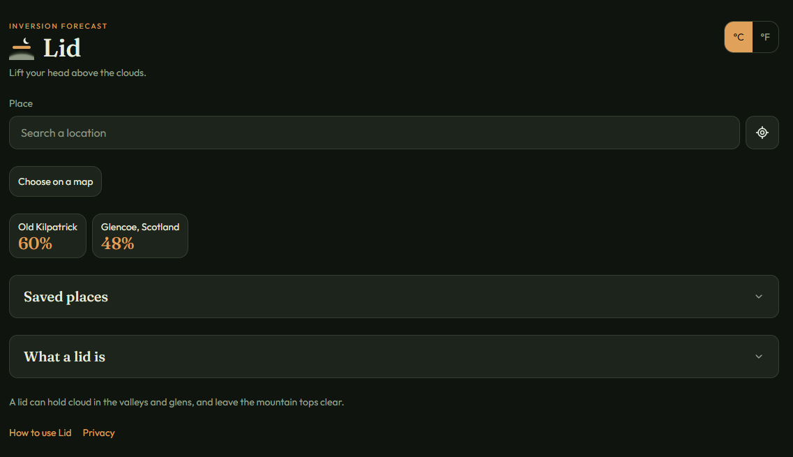
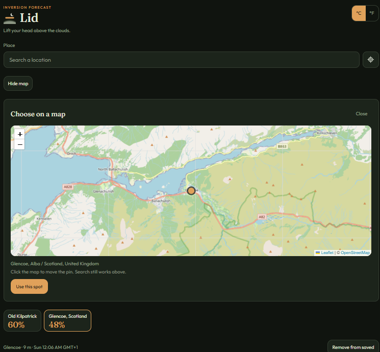
Search for a town, glen or hill, use your location, or choose a spot on the map.
Tap the long box and type a name, then tap the name that appears. Or tap the round target beside it and allow location. If you tap Don’t allow, nothing is broken. Type a place name instead. Or tap Choose on a map, tap the spot, then tap Use this spot.
2.Read the number
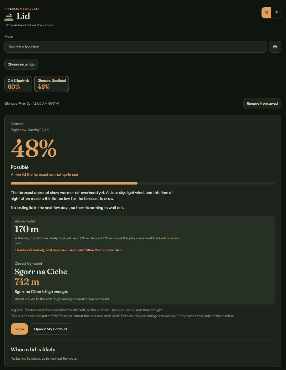
The large copper number is the chance of a lid at this particular spot during the hour shown.
It is not a percentage chance of sunshine, and it is not the chance of being above the cloud.
Under the number is a plain word: Very likely, Likely, Possible, Low chance, or Unlikely. The number is for that one spot, not a whole town or glen.
3.Look through the day
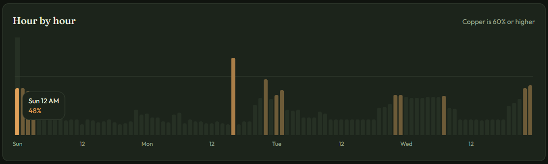
Look across the hours to see when the conditions are most likely.
Hour by hour is a row of bars. A taller bar means a higher chance. Copper means 60% or more. Tap a bar to read that hour.
4.Could the hill be above the cloud?
If the hill rises above the lid, its summit may be above the cloud while lower ground remains cloudy.
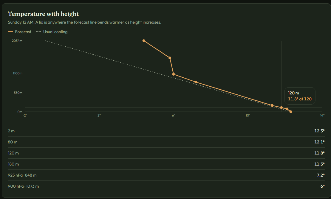
On the Glencoe result, Above the lid says about 170 m. The closest high point, Sgorr na Ciche, is 742 m, so it is high enough to look down on the lid. That screen also said cloud looked unlikely, so this hour might have been a clear view rather than a cloud deck.
Temperature with height shows how the air changes as you go up. Where warmer air sits above colder air, the line bends. That is the lid.
5.How certain is it?
For about the next day and a half, the percentage can sit about 20 points either side of the number. Further ahead, treat it as a hint. On the Glencoe result, that note sits under the hill.
A way to think it through
You want to know whether a hill might be clear above the cloud. Search for the place. Check the chance for the hour you care about, then look across the nearby hours. Then compare the lid height with the hill height.
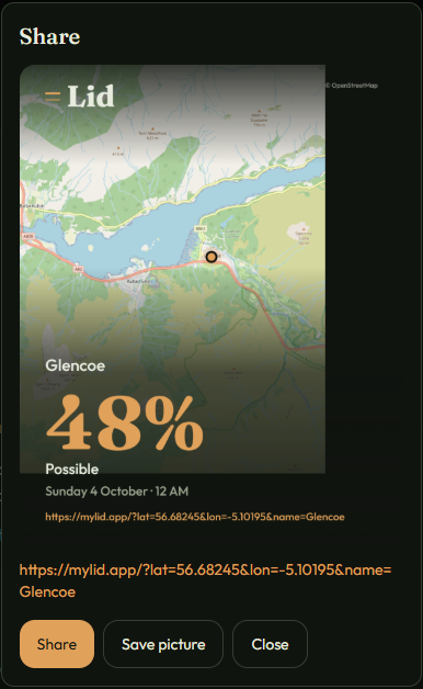
In these pictures, Glencoe at Sunday midnight was 48%, Possible. The lid was near 170 m, and Sgorr na Ciche at 742 m was high enough to be above it. The number was the chance of a lid, not a promise of a clear summit, and it will not be the same when you look.
6.The boxes you can open
Some titles have a small arrow. Tap a title to learn more. Tap it again to close it.
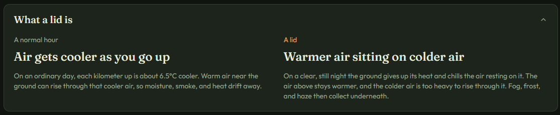
- What a lid is — see a normal hour compared with a lid.
- What this can mean — fog, frost, or a clear top.
- Frost — only on a clear, still night, when dew or frost is likely. Open it for the chance, and a link to Frost.
- Aurora — only when the lights may reach this sky. The word is Faint, Likely, or Strong, the same words Aurora uses. Open it for the reason, and a link to Aurora.
Why this number
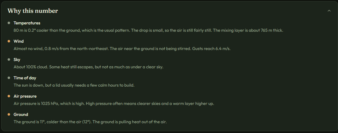
The chance is shaped by six things at that hour: the temperatures overhead, the wind, the sky, the time of day, the air pressure, and the ground.
A copper mark means that thing is making a lid more likely. A pale mark means it is not doing much either way. A dim mark means it is working against a lid.
Clear sky, light wind, the hours before dawn, higher pressure, and a cold or snowy ground all lean toward a lid. Strong wind, a covered sky, and daytime sun lean against one.
How this percentage is made
On a normal day the air gets cooler as you go up. A lid is a layer where it gets warmer instead. Air stops rising there, so fog, smoke, and cold stay underneath. Clear, calm nights make the common kind: the ground loses heat, and the air a little higher stays warmer. High pressure can add a second lid higher up, because sinking air warms. Snow and long winter nights make both stronger.
Lid reads the forecast for your spot. Temperatures a short way up, plus higher levels that actually sit above the ground, are the direct evidence. If the forecast already warms as you go up, the percentage is high. A bigger warm-up scores higher. Levels below the ground are ignored. They are not real air.
If the forecast still cools as you go up, a very thin lid can hide below the first height it can see. That case is marked as a guess. It uses the usual setup: open sky, light wind, the hours before dawn, higher pressure, a cold or snowy ground, and a shallow layer of still air. Those odds stay capped, because the forecast did not actually draw the lid.
The forecast covers a few kilometers, not one street. A valley floor can have a lid when a nearby ridge does not. The number is the chance at this spot over the next hours. It is not a guarantee, and it is not a substitute for a local forecast office when safety is the question.
Forecast data from Open-Meteo.
7.Save places
The two latest saved places sit under the search box, in tiles the same size as the search box. The name is on the left and the chance right now is on the right. Choose on a map is under those tiles.
You can save up to six places. The two latest stay under the search box. The other four are listed in the Saved places box, where you can rename or remove them.
Other things you can do
At the top right, change between °C and metres, or °F and feet. Use Share to make a picture of the current hour. Use On a photo to put that same hour on a picture from your phone. The original picture is left as it is.
Planning a night out?
Lid helps you see where cloud, mist and clear air may be found. Sky Contours helps with the other part of the plan — where the moon will be and how much moonlight will reach your chosen place at the time you want to be there.
Choose a place and time in Sky Contours to see where the moonlight falls across the landscape.
Open Sky Contours →A last note
Lid is for information, not a safety forecast. If you are driving, walking in cloud, or concerned about frost, use a local forecast as well.